CanalTour.org – Follow The Signs!
The I&M Canal National Heritage Area encompasses 862 square miles that include 5 counties, 60 communities and hundreds of historical sites. On your own, it would be easy to miss the fascinating stories behind some of our landmarks.
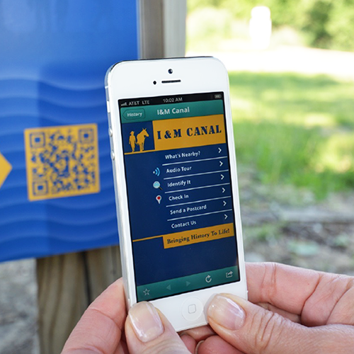
So, as a convenient way to aid your exploration, we’ve created over 200 signs that provide details on the specific site where the sign is located. Even more, each of these recognizable blue and yellow signs has a QR Code, which, once scanned on your smartphone, links you to a webpage that provides additional information, such as stories, historical fun facts, nearby attractions and restaurants.
We’ve collected all these webpages in our CanalTour.org site.
Where To Find The Signs
Look for signs near:


How To Use The QR Codes
Open your smartphone to your camera app.
Hold your device so that the QR Code appears in the viewfinder.
Your device should recognize the QR Code and show a notification. Tap the notification, and your phone will open up the website page associated with that code.